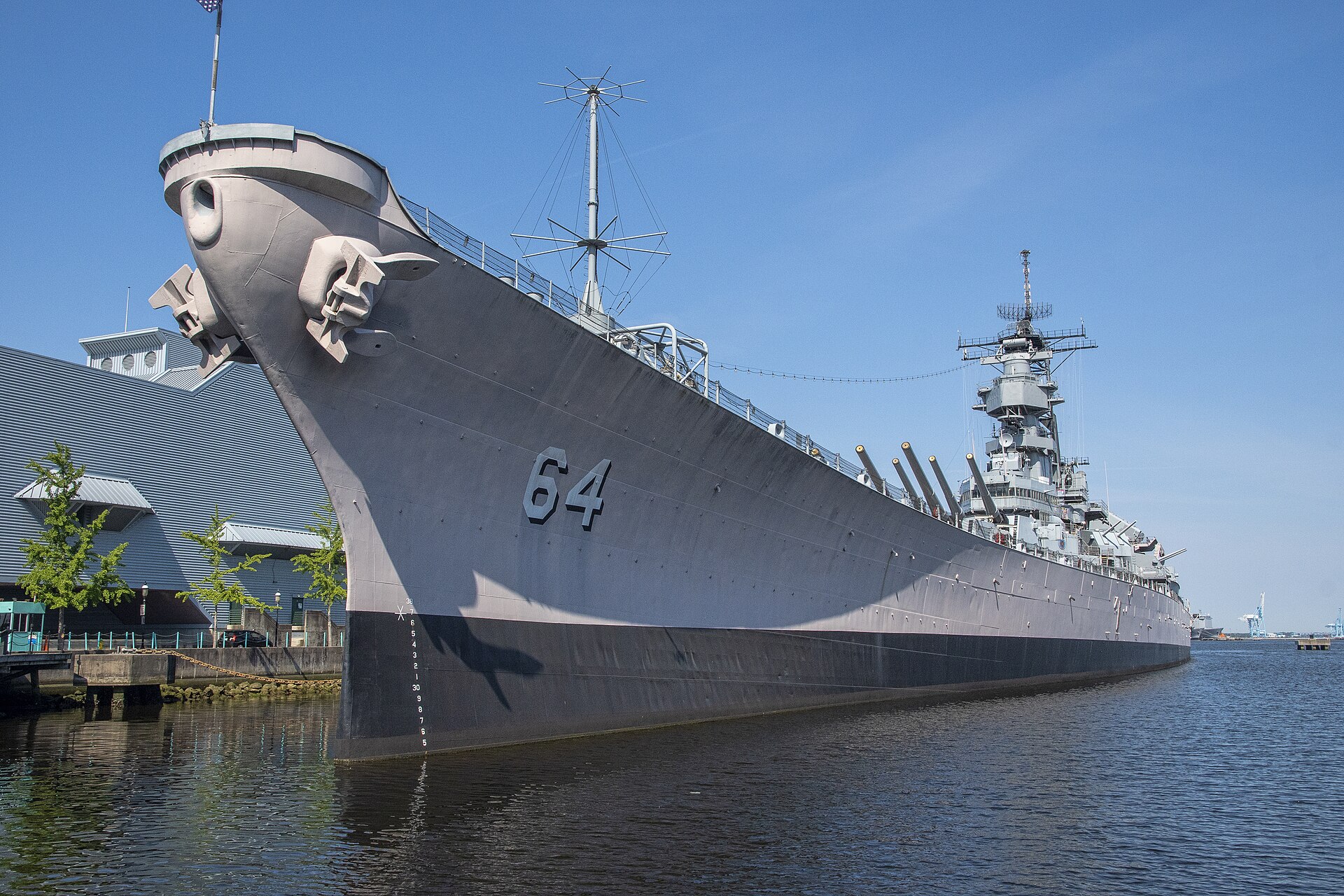
The battleship Wisconsin on the downtown Norfolk waterfront

Outdoors

Picnic spots near Norfolk

Day-use and picnic areas near Norfolk on public land, from quick drives to full-day outings.

6picnic areas
45 mito the closest
March–June, August–Novemberbest months

Good to know: Group picnic sites can often be reserved; fire rules change with the season, so check before bringing a grill.

Closest picks

1

Chesapeake Bay Virginia National Estuarine Research Reserve

45 mi northwest · National Oceanic and Atmospheric Administration

The Chesapeake Bay (VA) National Estuarine Research Reserve features four components that are all within the York River basin--Goodwin Islands, Catlett Islands, Taskinas Creek and Sweet Hall Marsh.


2

Fort Raleigh National Historic Site

71 mi southeast · National Park Service

Amongst the shallow blue waters of the Outer Banks lies Fort Raleigh on Roanoke Island. Shaped by constant winds of change, Fort Raleigh has become a focal point of American history.

3

Pax River Hog Point Campgrounds

101 mi north · Commander, Navy Installation Command (CNIC)

Visitors eligible for reservations at this location are limited to Active Duty, Reservists, Retired Military, Unremarried Widow, Veterans and Department of Defense employees.

Map of all 6 places

Map of 6 places loads as you scroll.

30 to 75 miles (2)

45 mi northwest · National Oceanic and Atmospheric Administration

Chesapeake Bay Virginia National Estuarine Research Reserve

The Chesapeake Bay (VA) National Estuarine Research Reserve features four components that are all within the York River basin--Goodwin Islands, Catlett Islands, Taskinas Creek and Sweet Hall Marsh.

  • Biking
  • Fishing
  • Hiking
  • History
  • Horseback riding
  • Hunting
  • Observation Site
  • Paddling

71 mi southeast · National Park Service

Fort Raleigh National Historic Site

Amongst the shallow blue waters of the Outer Banks lies Fort Raleigh on Roanoke Island. Shaped by constant winds of change, Fort Raleigh has become a focal point of American history.

  • History
  • Picnicking

75 miles and farther (4)

101 mi north · Commander, Navy Installation Command (CNIC) · Campground

Pax River Hog Point Campgrounds

Visitors eligible for reservations at this location are limited to Active Duty, Reservists, Retired Military, Unremarried Widow, Veterans and Department of Defense employees.

  • Biking
  • Boating
  • Camping
  • Canoeing
  • Crabbing
  • Fishing
  • Golf
  • Hunting

101 mi north · Commander, Navy Installation Command (CNIC) · Campground

Pax River Paradise Grove Campgrounds

Visitors eligible for reservations at this location are limited to Active Duty, Reservists, Retired Military, Unremarried Widow, Veterans and Department of Defense employees.

  • Camping
  • Canoeing
  • Crabbing
  • Fishing
  • Golf
  • Hunting
  • Kayaking
  • Paddle Boating

127 mi west · US Army Corps of Engineers · Campground

Longwood Park

Longwood Park is located on John H. Kerr Reservoir, a 50,000-acre lake that extends 39 miles up the wooded, cove-studded shoreline of the Roanoke River in Virginia and North Carolina.

  • Boating
  • Camping
  • Canoeing
  • Fishing
  • Picnicking
  • Swimming
  • Wildlife viewing

132 mi northwest · National Park Service · Campground

Telegraph Picnic Pavilion

Telegraph Picnic Pavilion is a covered pavilion with twelve picnic tables located in Prince William Forest Park, 35 miles (56 km) southwest of Washington, D.C.

  • Biking
  • Camping
  • Hiking
  • Picnicking
  • Wildlife viewing

Distances are straight-line miles from downtown Norfolk. Listings come from Recreation.gov’s federal recreation database; check each official page for hours, fees, fire restrictions and closures before you go.

Get outside around Norfolk

Best Things to Do in Norfolk, VA | Top Attractions & Hidden Gems with Quayvon video thumbnail

THINGS TO DO · YOUTUBE SHORT

Best Things to Do in Norfolk, VA | Top Attractions & Hidden Gems with Quayvon

A local activity Short shared by Assets Real Estate Team.

Watch on YouTube ↗

Around Norfolk

St. Paul's, Norfolk, Virginia
St. Paul's, Norfolk, VirginiaMichael Kotrady · CC BY-SA 3.0
Old Norfolk Public Library
Old Norfolk Public LibraryToohool · CC BY-SA 4.0
The Norfolk World Trade Center in Norfolk, Virginia
Norfolk World Trade CenterToohool · CC BY-SA 4.0

More outdoors near Norfolk

Questions

Where is the closest place for picnic spots near Norfolk?

Chesapeake Bay Virginia National Estuarine Research Reserve (National Oceanic and Atmospheric Administration), about 45 miles northwest of Norfolk as the crow flies. Next are Fort Raleigh National Historic Site (71 mi) and Pax River Hog Point Campgrounds (101 mi).

When is the best time for picnic spots near Norfolk?

Based on Norfolk’s average highs, March–June, August–November. Conditions at higher elevations can be much cooler.

Who manages these places?

Federal agencies including National Park Service, Commander, Navy Installation Command (CNIC), National Oceanic and Atmospheric Administration. Each listing links to its official page for hours, fees, closures and current conditions.

Norfolk AI

Your Norfolk local guide
Hey there!

I'm Norfolk AI. Ask about neighborhood food, independent shops, local history or planning a visit.

AI recommendations may be inaccurate. Verify hours and prices. Questions are processed by Cloudflare. Privacy